
Red Deer–Lacombe – Existing boundaries
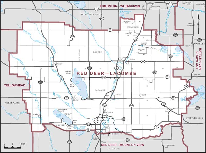
Consisting of:
- (a) Lacombe County;
- (b) Ponoka County;
- (c) that part of Red Deer County and the City of Red Deer lying northerly of a line described as follows: commencing at the intersection of the northwesterly limit of said county with Highway No. 11 (David Thompson Highway); thence generally easterly along said highway to the westerly limit of the City of Red Deer; thence southerly along said limit to the right bank of the Red Deer River; thence generally easterly along said bank to Taylor Drive; thence generally easterly along said drive, Ross (50) Street and its easterly production to 20 Avenue; thence northerly along said avenue to Highway No. 11 (David Thompson Highway); thence generally easterly along said highway to the northerly limit of said county; and
- (d) Louis Bull Indian Reserve No. 138B, Ermineskin Indian Reserve No. 138, Samson Indian Reserve No. 137, Samson Indian Reserve No. 137A and Montana Indian Reserve No. 139; the summer villages of Jarvis Bay and Norglenwold; the Town of Sylvan Lake.