
St. Albert–Edmonton – Existing boundaries
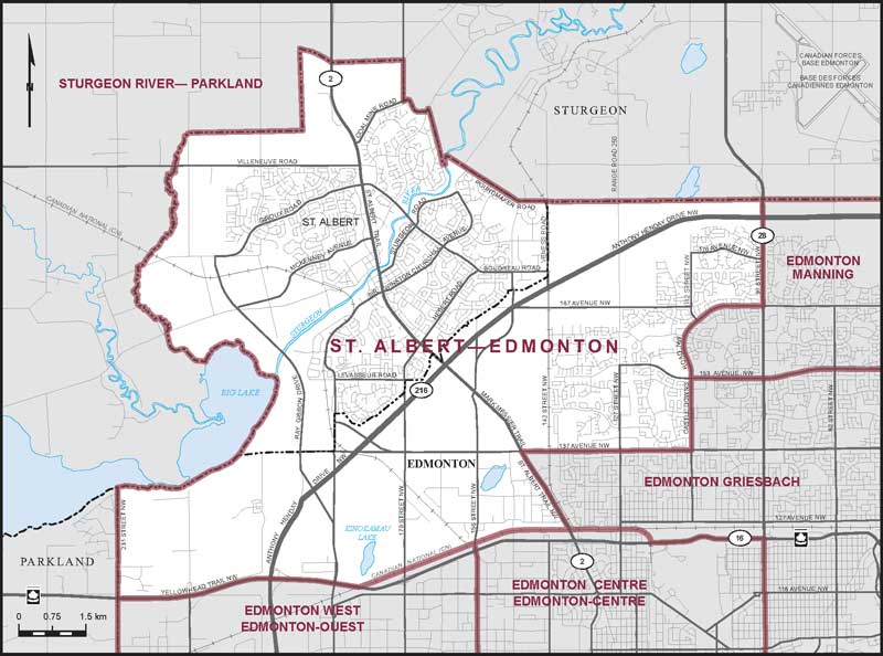
Consisting of:
- (a) the City of St. Albert; and
- (b) that part of the City of Edmonton lying westerly and northerly of a line described as follows: commencing at the intersection of the northerly limit of said city with 97 Street NW (Highway No. 28); thence southerly along said street to Castle Downs Road NW; thence generally westerly and generally southerly along said road to 137 Avenue NW; thence westerly along said avenue to St. Albert Trail NW (Highway No. 2); thence southeasterly along said trail to the Canadian National Railway; thence westerly and southwesterly along said railway to Yellowhead Trail NW (Highway No. 16); thence westerly along said trail to the westerly limit of the City of Edmonton.