
Burnaby North–Seymour – Existing boundaries
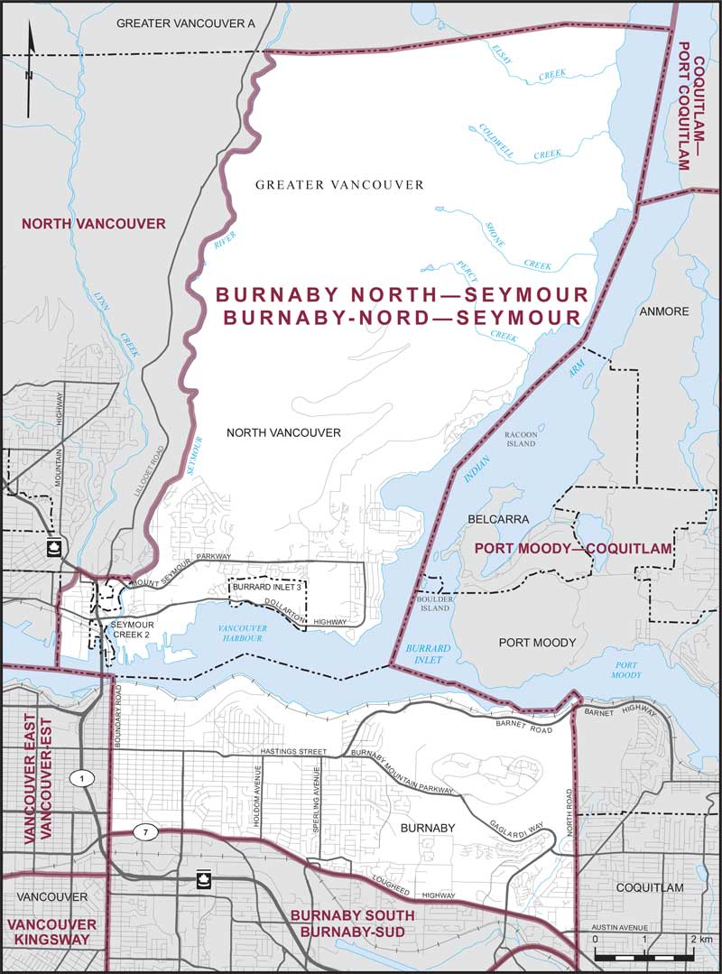
Consisting of those parts of the Greater Vancouver Regional District comprised of:
- (a) that part of the City of Burnaby lying northerly of a line described as follows: commencing at the intersection of the westerly limit of said city with Lougheed Highway (Highway No. 7); thence generally easterly along said highway to the easterly limit of said city;
- (b) that part of the District Municipality of North Vancouver lying easterly and southerly of a line described as follows: commencing at the intersection of the northerly limit of said district municipality with the western bank of the Seymour River; thence generally southerly along said bank to the northerly boundary of Seymour Creek Indian Reserve No. 2; thence generally westerly along said boundary to the Mount Seymour Parkway; thence westerly along said parkway to the Trans-Canada Highway (Highway No. 1); thence northwesterly along said highway to Lynn Creek; thence generally southerly along said creek to the westerly limit of said district municipality; and
- (c) Seymour Creek Indian Reserve No. 2 and Burrard Inlet Indian Reserve No. 3.