
Cariboo–Prince George – Existing boundaries
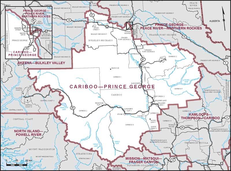
Consisting of:
- (a) those parts of the Regional District of Fraser-Fort George comprised of:
- (i) that part of the City of Prince George lying southerly and westerly of a line described as follows: commencing at the intersection of the westerly limit of said city with the Nechako River; thence generally southeasterly along said river to the Cariboo Highway (Highway No. 97); thence southerly along said highway to Massey Drive; thence northeasterly along said drive and Winnipeg Street to 15th Avenue; thence easterly along said avenue and Patricia Boulevard to the Queensway; thence southerly along the Queensway to Patricia Boulevard; thence generally easterly along said boulevard and its production to Yellowhead Highway (Highway No. 16); thence southeasterly along said highway to the Fraser River; thence generally southerly along said river to the southerly limit of said city;
- (ii) subdivisions C and E;
- (b) that part of the Bulkley-Nechako Regional District comprised of: Subdivision F; the District Municipality of Vanderhoof; and
- (c) Cariboo Regional District, excepting: subdivisions G, H and L; the District Municipality of 100 Mile House.