
Cloverdale–Langley City – Existing boundaries
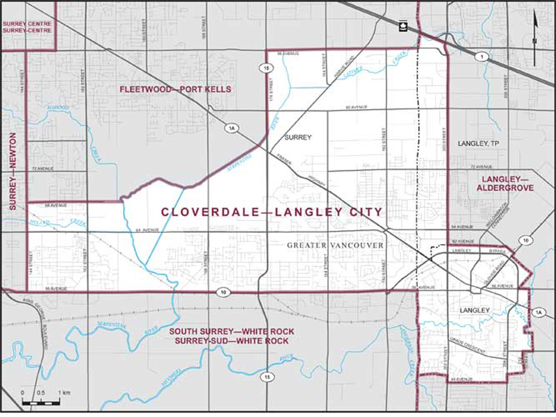
Consisting of those parts of the Greater Vancouver Regional District comprised of:
- (a) the City of Langley;
- (b) that part of the Township of Langley lying southerly and westerly of a line described as follows: commencing at the intersection of the westerly limit of said township with the Trans-Canada Highway (Highway No. 1); thence easterly along said highway to 200th Street; thence southerly along said street to the northerly limit of the City of Langley at 62nd Avenue; and
- (c) that part of the City of Surrey described as follows: commencing at the intersection of the easterly limit of said city with 88th Avenue; thence westerly along said avenue to 176th Street (Pacific Highway, Highway No. 15); thence southerly along said street to the Serpentine River; thence generally southwesterly along said river to the easterly production of 68th Avenue; thence westerly along said production and 68th Avenue to 144th Street; thence southerly along said street to Highway No. 10 (56th Avenue); thence easterly along said highway to 192nd Street; thence southerly along said street to 56th Avenue; thence generally easterly along said avenue to the easterly limit of said city; thence northerly along said limit to the point of commencement.