
South Okanagan–West Kootenay – Existing boundaries
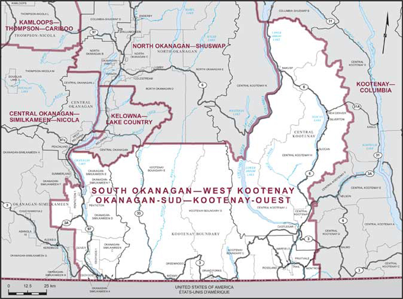
Consisting of:
- (a) the Regional District of Kootenay Boundary;
- (b) that part of the Regional District of Central Kootenay comprised of:
- (i) the City of Castlegar;
- (ii) the villages of New Denver, Silverton, Slocan and Nakusp;
- (iii) subdivisions H, I and J;
- (iv) that part of Subdivision K lying easterly of the Columbia River; and
- (c) those parts of the Regional District of Okanagan-Similkameen comprised of:
- (i) the City of Penticton;
- (ii) the towns of Oliver and Osoyoos;
- (iii) subdivisions A, C, D and E;
- (iv) those parts of Subdivision F described as follows:
- (A) commencing at the intersection of the easterly boundary of Penticton Indian Reserve No. 1 with the southerly limit of the District Municipality of Summerland; thence generally easterly along the limit of said district municipality to a point at approximate latitude 49°33'28"N and longitude 119°38'08"W; thence due east to the easterly limit of said subdivision; thence southerly along the easterly limit of said subdivision to the easterly boundary of Penticton Indian Reserve No. 1; thence generally northerly along said boundary to the point of commencement;
- (B) that part surrounded by the Penticton Indian Reserve No. 1;
- (v) Penticton Indian Reserve No. 1 and Osoyoos Indian Reserve No. 1.