
South Surrey–White Rock – Existing boundaries
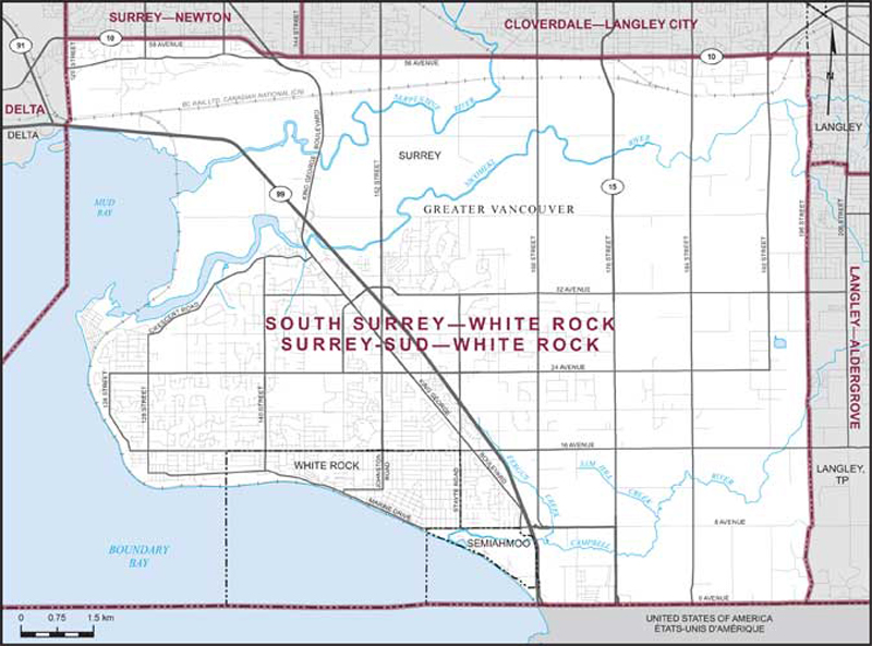
Consisting of those parts of the Greater Vancouver Regional District comprised of:
- (a) the City of White Rock;
- (b) that part of the City of Surrey lying southerly of a line described as follows: commencing at the intersection of the westerly limit of said city with Highway No. 10 (58th Avenue); thence easterly along said highway (58th Avenue and 56th Avenue) to 192nd Street; thence southerly along said street to 56th Avenue; thence generally easterly along said avenue to the easterly limit of said city; and
- (c) Semiahmoo Indian Reserve.