
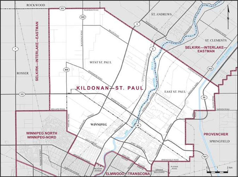
Kildonan–St. Paul – Existing boundaries
Consisting of:
- (a) the rural municipalities of East St. Paul and West St. Paul; and
- (b) that part of the City of Winnipeg lying northeasterly and northerly of a line described as follows: commencing at the intersection of the easterly limit of the City of Winnipeg (the northerly production of Plessis Road) with Springfield Road; thence westerly along said road to Lagimodiere Boulevard; thence southerly along said boulevard to Grassie Boulevard; thence westerly and northwesterly along Grassie Boulevard to McLeod Avenue; thence northwesterly along said avenue to Raleigh Street; thence northeasterly along said street to Oakland Avenue; thence northwesterly along said avenue and its northwesterly production to the Red River; thence generally southerly along said river to the southeasterly production of McAdam Avenue; thence northwesterly along said production, McAdam Avenue and its intermittent productions to Main Street; thence southwesterly along said street to Inkster Boulevard; thence northwesterly along said boulevard to McPhillips Street; thence northeasterly along said street to Leila Avenue; thence northwesterly along said avenue to Pipeline Road; thence northerly along said road to the westerly limit of the City of Winnipeg (Mollard Road).