
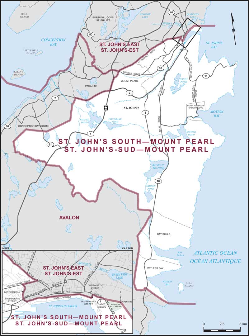
St. John's South–Mount Pearl – Existing boundaries
All that area consisting of:
- (a) that part of the City of St. John's lying southeasterly of the southeasterly limits of the towns of Conception Bay South and Paradise, and southeasterly of a line described as follows: commencing at the intersection of the westerly limit of the City of St. John's with Kenmount Road coincident with the northerly limit of the City of Mount Pearl; thence northeasterly and easterly along said road and Freshwater Road to Lemarchant Road; thence southerly along said road to Barter's Hill; thence generally southeasterly along Barter's Hill to Waldegrave Street; thence easterly and northeasterly along said street to Water Street; thence northerly and northeasterly along said street to Temperance Street; thence northwesterly along said street to Duckworth Street; thence northeasterly along said street to Signal Hill Road; thence northeasterly along said road to Cabot Avenue; thence northeasterly in a straight line to a point on Signal Hill at approximate latitude 47°34'31”N and longitude 52°41'21”W (on the northern boundary of the Johnson Geo Centre lot); thence due east in a straight line to the Atlantic Ocean;
- (b) the City of Mount Pearl; and
- (c) the towns of Petty Harbour-Maddox Cove, Bay Bulls and Witless Bay.
Including Gull Island and all islands adjacent to the shoreline of the above-described area.