
Halifax – Existing boundaries
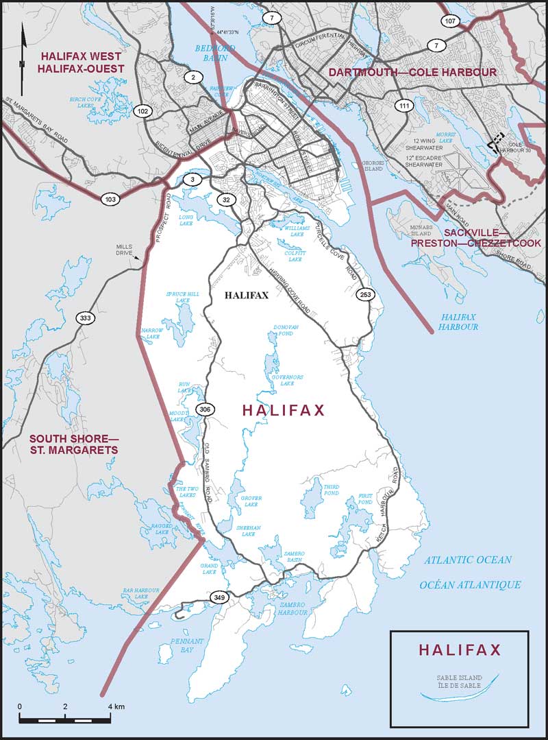
Consisting of:
- (a) that part of the Halifax Regional Municipality described as follows: commencing at a point in the Atlantic Ocean on the southerly limit of said regional municipality at latitude 44°25'20"N and longitude 63°42'20"W; thence northeasterly in a straight line to a point in Pennant Bay at latitude 44°27'19"N and longitude 63°41'00"W; thence northeasterly in a straight line to the mouth of the unnamed stream flowing from Bar Harbour Lake to Pennant Bay at approximate latitude 44°28'02"N and longitude 63°40'19"W; thence northeasterly in a straight line to the mouth of the Pennant River at the northwesternmost extremity of Grand Lake at approximate latitude 44°29'45"N and longitude 63°38'31"W; thence generally northwesterly along said river to Ragged Lake; thence generally northwesterly along the easterly shoreline of said lake to the Pennant River at approximate latitude 44°30'30"N and longitude 63°39'27"W; thence generally northerly along said river and The Two Lakes to the mouth of the unnamed brook at approximate latitude 44°31'35"N and longitude 63°39'12"W; thence northerly in a straight line to the northwesternmost extremity of Narrow Lake; thence northerly in a straight line to the intersection of Prospect Road (Highway No. 333) with Mills Drive; thence generally northerly along Prospect Road (Highway No. 333) to St. Margarets Bay Road (Highway No. 3); thence northwesterly along St. Margarets Bay Road (Highway No. 3) to Highway No. 103; thence northeasterly along said highway to Highway No. 102; thence northeasterly along said highway and its northbound split to Bayers Road; thence easterly along said road to the Canadian National Railway; thence generally northerly along said railway to Bedford Highway (Highway No. 2); thence westerly along said highway to its intersection with the Bedford Highway off-ramp situated northwest of Main Avenue; thence northwesterly in a straight line to the southernmost extremity of Fairview Cove; thence northerly in a straight line to a point in Bedford Basin at latitude 44°41'33"N and longitude 63°38'16"W; thence generally southeasterly along said basin, The Narrows and Halifax Harbour (passing to the east of Georges Island and to the west of McNabs Island) to a point in the Atlantic Ocean on the southerly limit of said regional municipality at latitude 44°33'43"N and longitude 63°30'00"W; thence generally southerly and westerly along the limit of said regional municipality to the point of commencement; including Georges Island; and
- (b) Sable Island.