
South Shore–St. Margarets – Existing boundaries
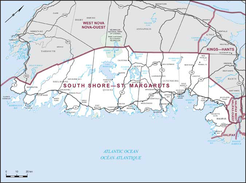
Consisting of:
- (a) the County of Lunenburg;
- (b) the Region of Queens Municipality;
- (c) the County of Shelburne; and
- (d) that part of the Halifax Regional Municipality lying westerly of a line described as follows: commencing at the intersection of the northerly limit of said regional municipality with the westerly shoreline of Pockwock Lake; thence generally southerly along said shoreline to the westernmost extremity of Ponhook Cove in Pockwock Lake; thence southerly in a straight line to the mouth of the Pockwock River at Wrights Lake; thence southeasterly in a straight line to the northernmost extremity of Stillwater Lake at the mouth of Burns Runs; thence southerly along said lake to Hammonds Plains Road (Highway No. 213); thence southwesterly along said road to Highway No. 103; thence generally southeasterly along said highway to St. Margarets Bay Road (Highway No. 3); thence southeasterly along said road to Prospect Road (Highway No. 333); thence generally southerly along said road to Mills Drive; thence southerly in a straight line to the northwesternmost extremity of Narrow Lake; thence southerly in a straight line to the mouth of an unnamed brook on the Pennant River at approximate latitude 44°31’35”N and longitude 63°39’12”W; thence generally southerly along said river and The Two Lakes to Ragged Lake at approximate latitude 44°30’30”N and longitude 63°39’27”W; thence generally southeasterly along the easterly shoreline of said lake and the Pennant River to the most northwesterly extremity of Grand Lake at approximate latitude 44°29’45”N and longitude 63°38’31”W; thence southwesterly in a straight line to the mouth of the unnamed stream flowing from Bar Harbour Lake into Pennant Bay at approximate latitude 44°28’02”N and longitude 63°40’19”W; thence southwesterly in a straight line to a point in the Atlantic Ocean at latitude 44°27’19”N and longitude 63°41’00”W; thence southwesterly in a straight line to a point in the Atlantic Ocean on the southerly limit of said regional municipality at latitude 44°25’20”N and longitude 63°42’20”W.