
West Nova – Existing boundaries
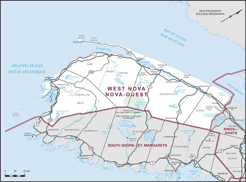
Consisting of:
- (a) the counties of Annapolis, Digby and Yarmouth; and
- (b) that part of the County of Kings lying westerly of a line described as follows: commencing at a point where Canada Creek flows into the Minas Channel in the Bay of Fundy at approximate latitude 45°10’17”N and longitude 64°44’34”W; thence southerly along said creek to Black Rock Road; thence generally southerly along said road to Highway No. 101; thence easterly along said highway to the westerly boundary of Cambridge Indian Reserve No. 32; thence southerly along said boundary to the northerly production of Miller Lane; thence southerly along said production, said lane and its southerly production to the north end of Joudrey Mountain Road; thence southerly along said road to Randolph Road; thence easterly along said road to Sharpe Brook; thence generally southerly along said brook to Prospect Road; thence southwesterly in a straight line to the intersection of Arenburgs Meadows Brook with North River Road; thence southerly in a straight line to the southwesternmost extremity of Four Mile Lake; thence southeasterly in a straight line to the southerly limit of the County of Kings.