
Laurier–Sainte-Marie – Existing boundaries
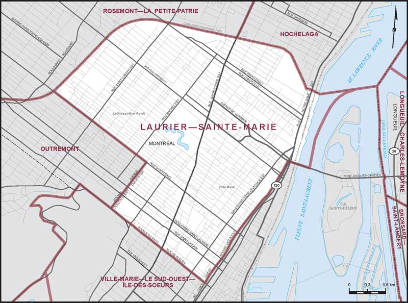
Consisting of that part of the City of Montréal comprised of:
- (a) that part of the borough of Le Plateau-Mont-Royal lying northeasterly and southeasterly of a line described as follows: commencing at the intersection of the northwesterly limit of said borough with Saint-Denis Street; thence southeasterly along said street to Duluth Avenue East; thence southwesterly along said avenue and Duluth Avenue West to du Parc Avenue; thence southeasterly along said avenue to the southeasterly limit of the borough of Le Plateau-Mont-Royal; and
- (b) that part of the borough of Ville-Marie lying northeasterly and northwesterly of a line described as follows: commencing at the intersection of the northwesterly limit of said borough with de Bleury Street; thence southeasterly along said street to Viger Avenue West; thence northeasterly along said avenue and Viger Avenue East to the Jacques-Cartier Bridge; thence easterly along said bridge to the St. Lawrence River (westerly of Sainte-Hélène Island); thence northerly and easterly along said river (passing westerly and northerly of the said island) to the intersection of the easterly limit of the City of Montréal with the northerly limit of the borough of Ville-Marie.