
Kenora – Existing boundaries
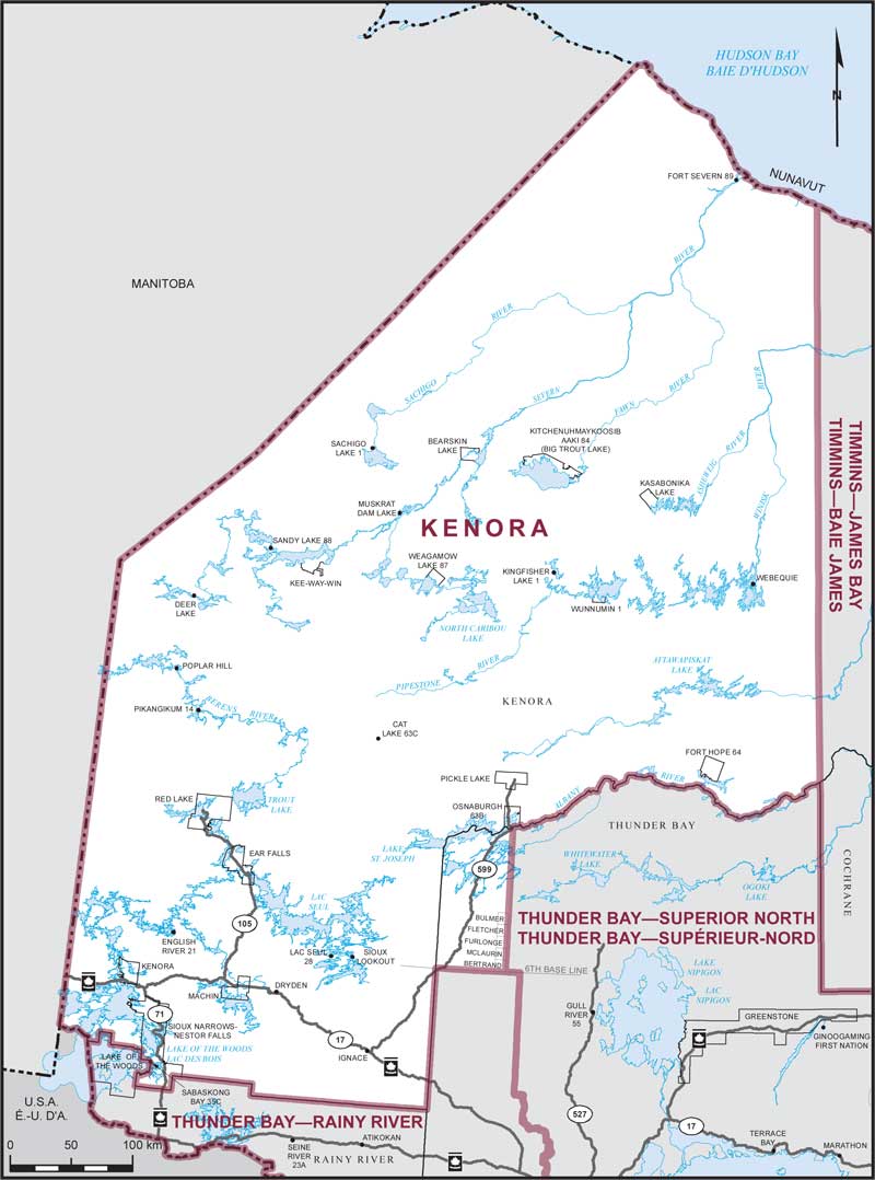
Consisting of:
- (a) that part of the Territorial District of Kenora lying westerly of a line described as follows: commencing at the northeast corner of the most northerly point of the Territorial District of Thunder Bay (at Albany River); thence due north to the northerly boundary of the Province of Ontario;
- (b) that part of the Territorial District of Thunder Bay lying northerly and westerly of a line described as follows: commencing at the intersection of the westerly limit of said territorial district with the 6th Base Line; thence easterly along said base line to the southeast corner of the geographic Township of Bertrand; thence northerly along the easterly boundary of the geographic townships of Bertrand, McLaurin, Furlonge, Fletcher and Bulmer to the northeast corner of the geographic Township of Bulmer; thence due north to the northerly limit of said territorial district (east of Highway No. 599); and
- (c) that part of the Territorial District of Rainy River comprised of Sabaskong Bay (Part) Indian Reserve No. 35C.