
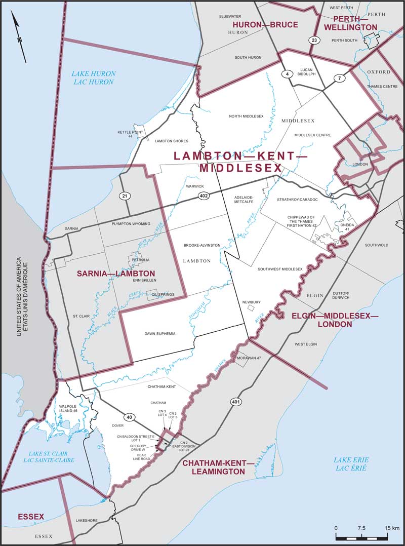
Lambton–Kent–Middlesex – Existing boundaries
Consisting of:
- (a) that part of the County of Lambton comprised of:
- (i) the municipalities of Brooke-Alvinston and Lambton Shores;
- (ii) the townships of Dawn-Euphemia and Warwick;
- (iii) Kettle Point Indian Reserve No. 44 and Walpole Island Indian Reserve No. 46;
- (b) that part of the Municipality of Chatham-Kent lying northwesterly of the Thames River, excepting that part of said municipality described as follows: commencing at the intersection of the Thames River with the southeasterly production of Bear Line Road; thence northwesterly along said production and Bear Line Road to Gregory Drive West; thence northeasterly along said drive to the northeasterly boundary of Lot 23, Concession 2, East Division of the geographic Township of Dover; thence northwesterly along said boundary and the northeasterly boundary of Lot 1, Concession Baldoon Street East of the geographic Township of Dover to the northwesterly boundary of said lot; thence northeasterly along the northeasterly production of said boundary to the northeasterly boundary of Lot 4, Concession 3 of the geographic Township of Chatham; thence southeasterly along said boundary to the northwesterly boundary of Lot 5, Concession 2 of the geographic Township of Chatham; thence southwesterly along said boundary to the southwesterly boundary of Lot 5, Concession 2 of the geographic Township of Chatham; thence southeasterly along said boundary to the Thames River; thence generally southwesterly along said river to the point of commencement; and
- (c) the County of Middlesex, excepting the Municipality of Thames Centre.