
Mississauga–Streetsville – Existing boundaries
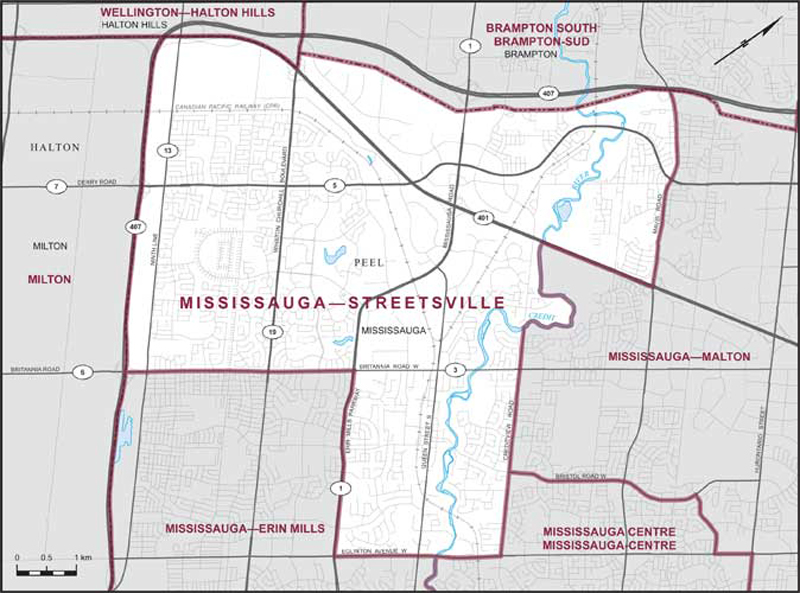
Consisting of that part of the Regional Municipality of Peel comprised of that part of the City of Mississauga described as follows: commencing at the intersection of the southwesterly limit of said city with Britannia Road West; thence northeasterly along said road to Erin Mills Parkway; thence southeasterly along said parkway to Eglinton Avenue West; thence northeasterly along said avenue to Creditview Road; thence northwesterly along said road to the Credit River; thence generally northerly, generally southwesterly and northwesterly along said river to Highway No. 401; thence northeasterly along said highway to Mavis Road; thence northwesterly along said road to the northwesterly limit of said city; thence generally southwesterly and southeasterly along the northwesterly and southwesterly limits of the City of Mississauga to the point of commencement.