
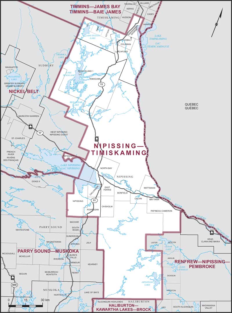
Nipissing–Timiskaming – Existing boundaries
Consisting of:
- (a) the Territorial District of Nipissing, including Nipissing Indian Reserve No. 10, excepting:
- (i) that part of the Territorial District of Nipissing lying southerly and easterly of a line described as follows: commencing at the northeast corner of the geographic Township of Deacon; thence westerly and southerly along the northerly and westerly boundaries of said geographic township to the northeast corner of the geographic Township of Lister; thence westerly, southerly and easterly along the northerly, westerly and southerly boundaries of said geographic township to the northwest corner of the geographic Township of Anglin; thence southerly along the westerly boundary of the geographic townships of Anglin, Dickson and Preston to the northerly boundary of the geographic Township of Airy; thence westerly along said boundary to the northeast corner of the County of Haliburton;
- (ii) the Municipality of West Nipissing;
- (b) that part of the Territorial District of Parry Sound comprised of: the municipalities of Callander and Powassan; the Township of Nipissing; and
- (c) that part of the Territorial District of Timiskaming lying southerly of a line described as follows: commencing at the intersection of the easterly limit of said territorial district with the southerly limit of the Township of Harris; thence northwesterly and northerly along the southerly and westerly limits of said township to the northerly limit of the City of Temiskaming Shores; thence westerly and southerly along the northerly and westerly limits of said city to the northerly limit of the Township of Coleman; thence westerly along said limit to the easterly shoreline of the Montreal River; thence northwesterly along said shoreline to the northerly boundary of the geographic Township of Kittson; thence westerly along said boundary and the northerly boundary of the geographic townships of Dane and Leo to the northwestern corner of the geographic Township of Leo; thence southerly along the westerly boundary of said geographic township to the southerly limit of said territorial district.