
Thunder Bay–Superior North – Existing boundaries
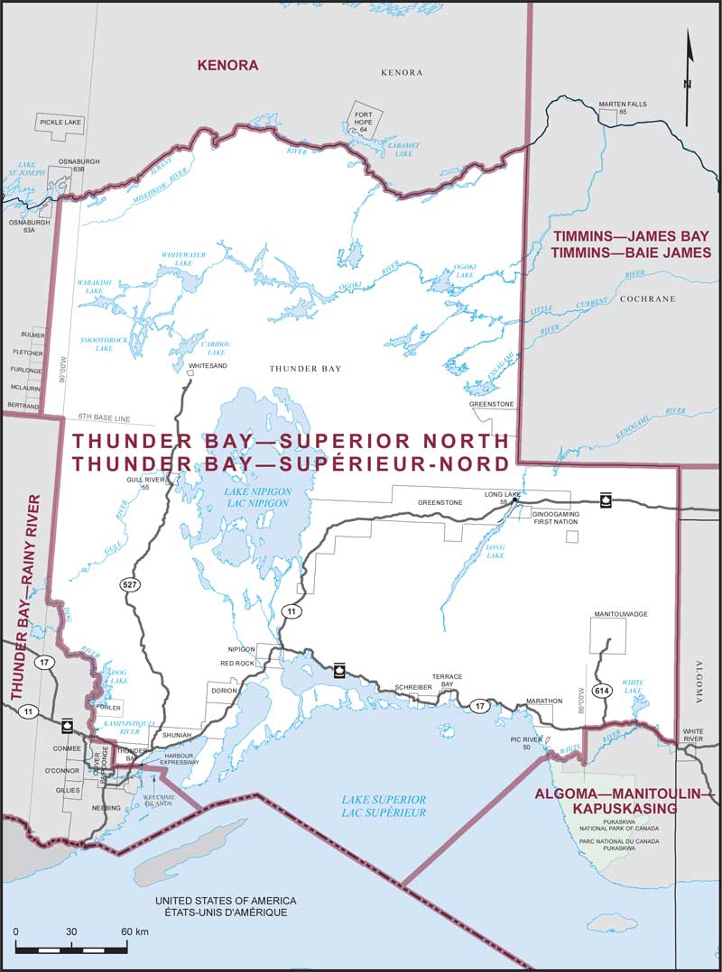
Consisting of the Territorial District of Thunder Bay, excepting:
- (a) that part lying westerly of a line described as follows: commencing at the intersection of the northerly limit of said territorial district with a line running due north from the northeast corner of the geographic Township of Bulmer; thence due south to the northeast corner of said geographic township; thence southerly along the easterly boundary of the geographic townships of Bulmer, Fletcher, Furlonge, McLaurin and Bertrand to the 6th Base Line; thence easterly along said base line to longitude 90°00'W; thence southerly along said longitude to its most southerly intersection with the Dog River; thence generally southeasterly along said river, Taman Lake, the Dog River and the western shoreline of Dog Lake to the northerly boundary of the geographic Township of Fowler; thence westerly, southerly and easterly along the northerly, westerly and southerly boundaries of said geographic township to the Kaministiquia River; thence generally southerly along said river, Little Dog Lake and the Kaministiquia River to the northerly limit of the Municipality of Oliver Paipoonge; thence easterly along said limit to the westerly limit of the City of Thunder Bay; thence southerly and easterly along said limit to the Trans-Canada Highway (Highway No. 11, Highway No. 17); thence easterly along said highway, Harbour Expressway, Main Street and its easterly production to the easterly limit of the City of Thunder Bay; thence southwesterly, easterly and southerly along said limit to the northeast corner of the Municipality of Neebing situated easterly of Welcome Islands; thence S45°00'E to the international boundary between Canada and the United States of America; and
- (b) that part lying southerly of a line described as follows: commencing at the intersection of the easterly limit of said territorial district with the Trans-Canada Highway (Highway No. 17); thence generally westerly along said highway to longitude 86°00'W; thence southerly along said longitude to the White River; thence generally westerly along said river to the northern shoreline of Lake Superior; thence S45°00'W to the international boundary between Canada and the United States of America.