
University–Rosedale – Existing boundaries
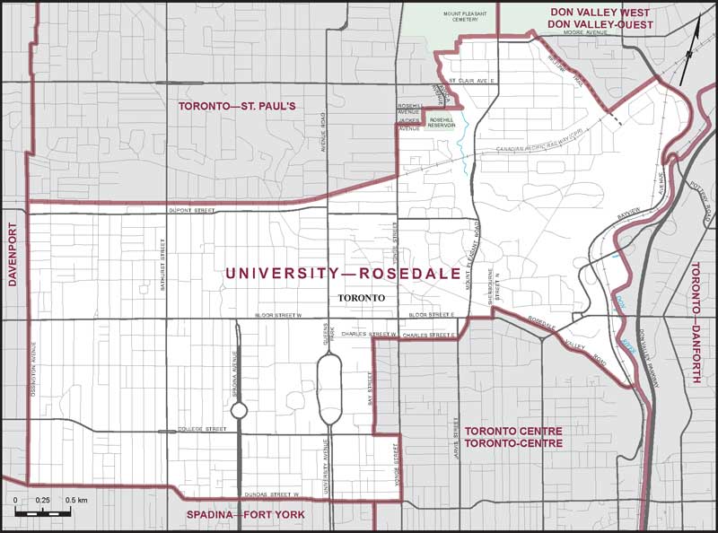
Consisting of that part of the City of Toronto described as follows: commencing at the intersection of College Street with Bay Street; thence northerly along Bay Street to Charles Street West; thence easterly along said street to Yonge Street; thence southerly along said street to Charles Street East; thence easterly along said street to Mount Pleasant Road; thence northerly along said road to Bloor Street East; thence easterly along said street to Sherbourne Street North; thence northerly along said street to Rosedale Valley Road; thence generally easterly along said road and its production to the Don River; thence generally northerly along said river to Pottery Road; thence northwesterly and southwesterly along said road to Bayview Avenue; thence generally northerly and northwesterly along said avenue to the Canadian Pacific Railway situated northwesterly of Nesbitt Drive; thence southwesterly along said railway to the Beltline Trail situated in the Moore Park Ravine; thence generally northwesterly along said trail to the southerly boundary of the Mount Pleasant Cemetery; thence generally westerly along said boundary to the northwesterly production of the Don River Tributary situated easterly of Avoca Avenue; thence generally southeasterly along said production and said tributary to the easterly production of Rosehill Avenue; thence westerly along said production and Rosehill Avenue to the westerly boundary of the Rosehill Reservoir; thence southerly along said boundary to Jackes Avenue; thence westerly along said avenue to Yonge Street; thence southerly along said street to the Canadian Pacific Railway; thence generally westerly along said railway to Ossington Avenue; thence southerly along said avenue to Dundas Street West; thence generally easterly along said street to Yonge Street; thence northerly along said street to College Street; thence westerly along said street to the point of commencement.