
Comment 49 – comments and feedback
Back to all comments and feedback from the public
Al Kivi
Submission – Electoral boundaries for proposed St. Clair – Mount Pleasant riding
"All politics are local" is a popular political saying most often associated with U.S. House Speaker Tip O'Neill. The corollary of this is "all political boundaries should be local."
Our local residents have enjoyed living in a community of interest for almost 180 years that was only recently split apart into two ridings. We enjoyed representation from a single elected representative for almost 150 years.
The proposed electoral district redistribution of the St. Clair – Mount Pleasant riding boundary will realign our municipal boundaries to support the shared history of Davisville Village residents.
The primary focus of the submission relates to the boundaries of the municipal wards and the historical context that supports the realignment. However, joining together of our split-ward catchment will also simplify our representation provincially and federally.
Let us explore this further.
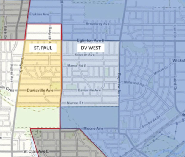
Who we are
The South Eglinton Davisville Residents' Association is bounded by Eglinton to the north, Merton to the south, Bayview to the east and Yonge to the west. The residents' association catchment boundaries have remained constant for over 58 years.
Original Davisville Village boundaries
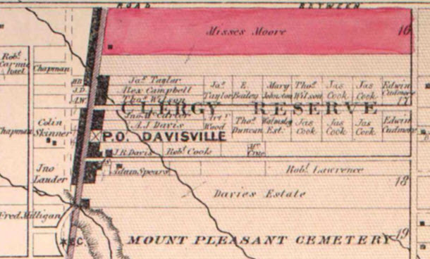
The origins of Davisville Village began with the arrival of John Davis in 1840. In 1845, John Davis set up a pottery at the corner of what is now Yonge Street and Millwood Road. The village grew around the pottery. Initially known as Davis' Corners, it soon acquired a post office known as Davisville, with John Davis as postmaster.
Thus, a community of interest was born.
The Village of Davisville boundaries grew to extend to Eglinton to the north, Bayview to the east, Merton to the south and Oriole Parkway to the west.
Boundaries stay the same in the Town of North Toronto
The Town of North Toronto was formed in 1890 from the unincorporated villages of Davisville and Eglinton. The village of Bedford Park joined in 1892. The Town had its own schools, waterworks and police service.
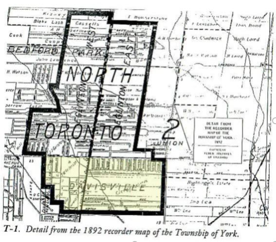
The above map shows the boundaries of Davisville within the Town of North Toronto.
The Town of North Toronto was subsequently annexed by the City of Toronto in 1912 and became part of a larger Ward 9 within the City.
Mount Pleasant road came later
Note that Mount Pleasant Road is not shown on the early maps before 1910. Maps from 1913 show a Mount Pleasant Road extending from Eglinton down to Merton. By 1919 Mount Pleasant Road was open for traffic from St. Clair north to the Blythwood Ravine.
Mount Pleasant Road is not an appropriate boundary road.
Davisville Village boundaries until 1964
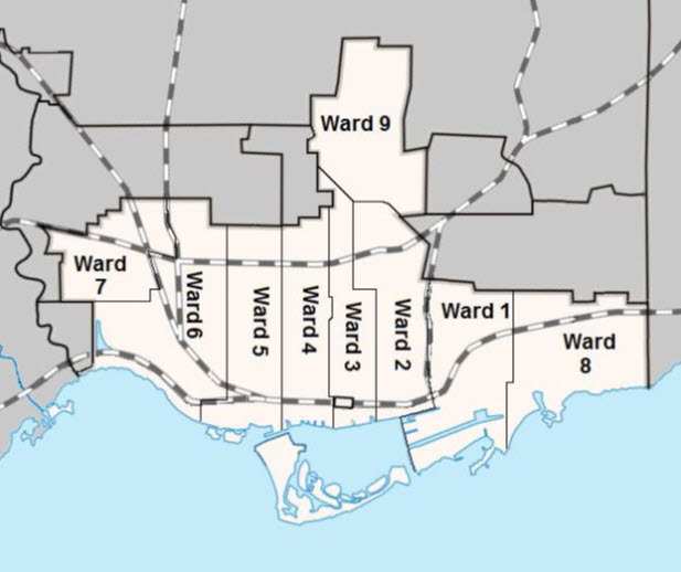
Municipal electoral maps from 1964 show that the Davisville Village area continued as a part of Ward 9 up until this period. SEDRA (originally SERA and then SERRA) was founded in 1965 to deal in part with issues related to proposed developments in Ward 9 on both sides of Mount Pleasant Road.
Fast forward from 1965 to 2018
SEDRA residents were represented by a single councillor in the period between 1965 and 2018. Mount Pleasant Road was not a boundary road and planning issues were addressed within a single planning council often with the support of the local councillor.
Ford government broke the mould in 2018
On July 27th, 2018, the Ford government proposed a change to the ward model in the City of Toronto that would result in community representation by two councillors and planning decision making from two separate planning councils.
The ward boundary changes were made unilaterally without consultation with municipal stakeholders. The subsequent election in 2018 was chaotic, and chaos persists today. Many residents no longer understand their municipal boundaries. The North York Community and Planning councils now make key planning decisions for the eastern portion of our split catchment.
Chaos continues four years later … with city planning divisions arriving at different approaches to common problems. We find that the North York Committee of Adjustment tribunal decision making is significantly different from the Toronto-East York Committee of Adjustment decision making to our detriment. The North York decisions are out of touch with the planning needs of a growing midtown neighbourhood.
We support the proposed realignment of riding and ward
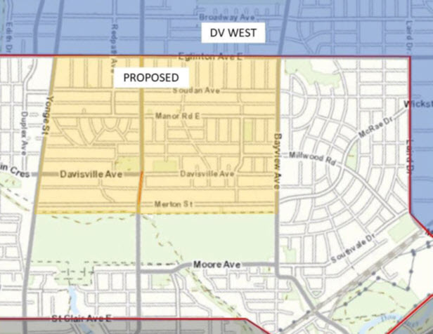
The proposed redistribution returns us to the pre-existing condition in the period from 1840 to 2018 where Davisville Village is represented by one councillor and the same planning district.
The SEDRA board supports the proposed changes for St. Clair – Mount Pleasant that will join our catchment.
We understand that our sister residents' associations may be disadvantaged by the proposed changes and we, of course, support additional changes that respect their local interests.
Yours sincerely,
Al Kivi SEDRA Board Member
cc: Councillor – Josh Matlow – Toronto-St. Paul's Councillor – Jaye Robinson – Don Valley West MPP – Jill Andrew – Toronto-St. Paul's MPP – Stephanie Bowman – Don Valley West MP – Carolyn Bennett – Toronto-St. Paul's MP – Rob Oliphant – Don Valley West SEDRA board