Comment 36 – comments and feedback
Back to all comments and feedback from the public
Connor Peters
District / Circonscription : Niagara West / Niagara-Ouest
Suggested Name English / Nom suggéré anglais : Niagara West
Suggested Name French / Nom suggéré français : Niagara-Ouest
Comments / Commentaires:
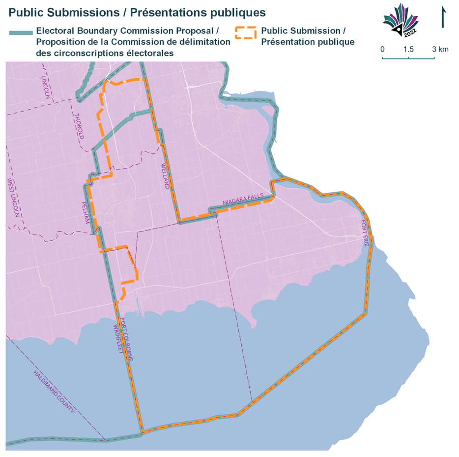
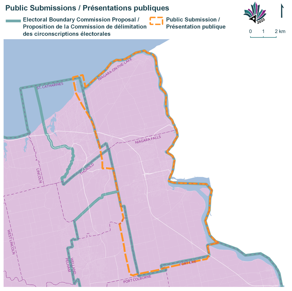
This map provides clearer boundary separations and more accurately depicts the municipal and cultural separations of the residents of these areas. Using both natural and man-made boundaries, the map would make it easier for both residents and campaigns to understand the boundaries of the riding. This map also allows many of the micro-communities in the Niagara area to have consistent representation under one single MP, as opposed to cutting city blocks in half. Some major divisions (e.g. Merritville Highway, the Welland Canal, South Pelham Rd., etc) are considered the social boundaries between the two areas, so they provide a common sense boundary for the riding.
The one major change that this map includes is removing downtown Thorold from Niagara West, and instead picking up small pieces of western St. Catharines, Thorold, Welland, and Port Colborne. This more accurately depicts the communities that live here, as well as keeping the population estimates within the desired average.
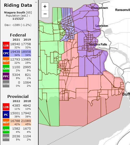
District / Circonscription : Niagara South / Niagara-Sud
Suggested Name English / Nom suggéré anglais : Niagara South
Suggested Name French / Nom suggéré français : Niagara-Sud
Comments / Commentaires:
This map provides clearer boundary separations and more accurately depicts the municipal and cultural separations of the residents of these areas. Using both natural and man-made boundaries, the map would make it easier for both residents and campaigns to understand the boundaries of the riding. With Highway 58 to the North, Merritville Hwy / Welland Canal to the West, Thorold Townline Road to the East, these divisions make minor but important adjustments to the riding.
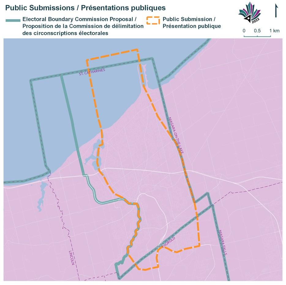
This proposed riding utilizes something closer to the current map as opposed to the original proposal; It has St Catharines and Niagara South sharing a border, without Niagara West including downtown Thorold. The entirety of Brock University falls in my proposed St. Catharines riding.
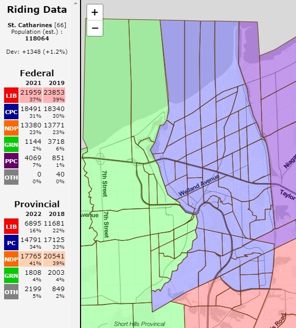
District / Circonscription : St. Catharines
Suggested Name English / Nom suggéré anglais : St. Catharines
Suggested Name French / Nom suggéré français : St. Catharines
Comments / Commentaires:
This map provides clearer boundary separations and more accurately depicts the municipal and cultural separations of the residents of these areas. Using both natural and man-made boundaries, the map would make it easier for both residents and campaigns to understand the boundaries of the riding.
This map utilizes Twelve Mile Creek to the West, the Welland Canal to the east, and Highway 58 to the south as its boundaries. The major difference between this map and the committee's proposal is that St. Catharines shares its southern border with Niagara South as opposed to Niagara West. The entirety of Brock University resides in St. Catharines in this proposal.
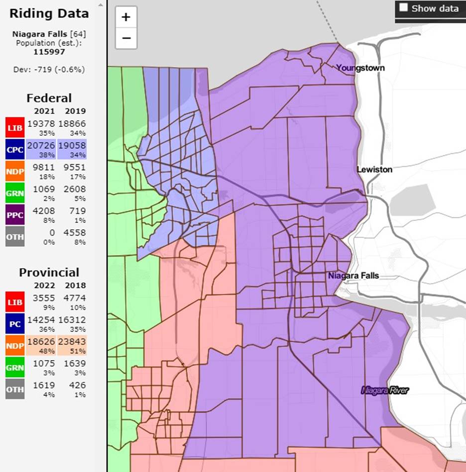
District / Circonscription : Niagara Falls
Suggested Name English / Nom suggéré anglais : Niagara Falls
Suggested Name French / Nom suggéré français : Niagara Falls
Comments / Commentaires:
This map provides clearer boundary separations and more accurately depicts the municipal and cultural separations of the residents of these areas. Using both natural and man-made boundaries, the map would make it easier for both residents and campaigns to understand the boundaries of the riding.
This Riding uses the Niagara River (and US border) to the east, Welland Canal/ Thorold Townline Rd/Moyer Rd on the west, and Netherby Road on the south as boundaries, with a jog over at the Welland River. This proposal includes Port Weller and Cooks Mills as part of the Niagara Falls riding. Population is within reasonable average.
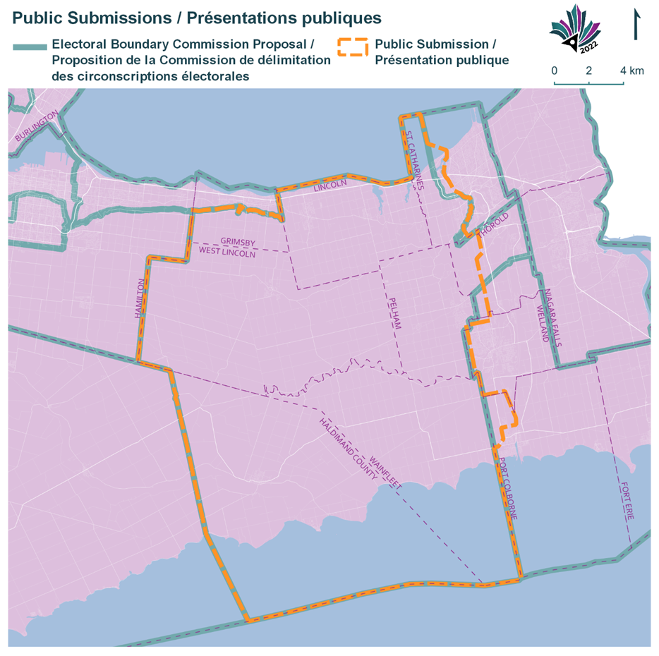
Additional maps provide by submitter / Cartes supplémentaires fournies par le demandeur :