Appendix C – Boundary Descriptions and Maps not included in Appendix A – British Columbia
There shall be in the Province of British Columbia forty-three (43) electoral districts, named and described as follows, each of which shall return one member of Parliament.
In the following descriptions:
- any reference to "road," "highway," "boulevard," "street," "avenue," "drive," "way," "viaduct," "railway," "strait," "channel," "inlet," "bay," "arm," "lake," "creek," "reach," "sound," "passage" or "river" signifies the centre line unless otherwise described;
- wherever a word or expression is used to denote a municipal area, a land district, a regional district electoral area or a regional district, such word or expression shall indicate the territorial division as it existed or was bounded on the first day of January 2021;
- when describing the federal electoral district's perimeter, all district municipalities, cities, towns, villages, and Indian reserves lying within its perimeter are included unless otherwise described;
- all First Nation territories lying within the perimeter of the electoral district are included unless otherwise described;
- all Indian reserves, villages, towns, cities, district municipalities or regional district electoral areas encompassed by a larger described entity are included unless otherwise described;
- the translation of the terms "street," "avenue" and "boulevard" follows Treasury Board standards, while the translation of all other public thoroughfare designations is based on commonly used terms but has no official recognition; and
- all coordinates are in reference to the North American Datum of 1983 (NAD 83).
- The population figure of each electoral district is derived from the 2021 decennial census.
Boundary descriptions
- Abbotsford—South Langley
- Burnaby Central
- Burnaby North—Seymour
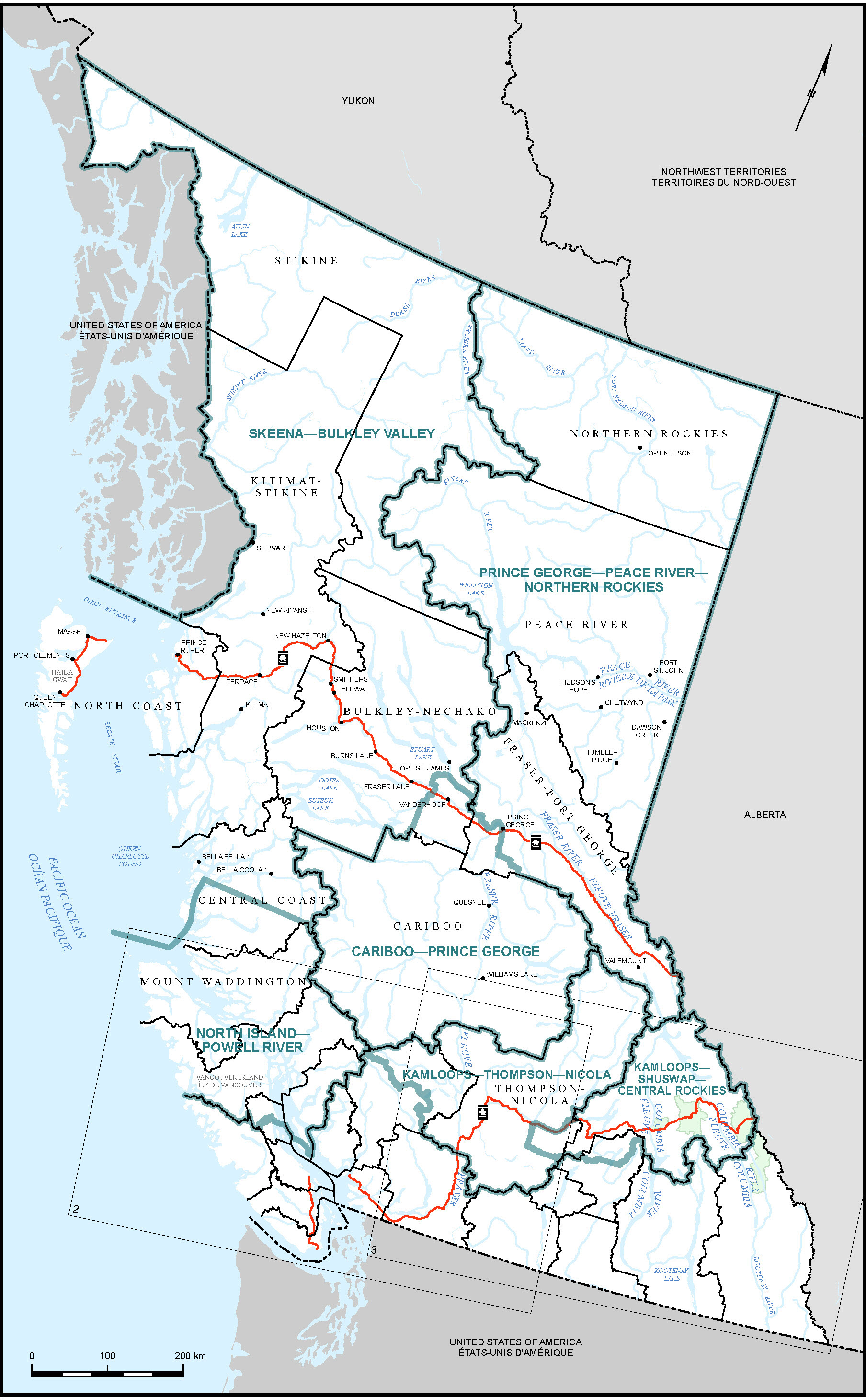
- Cariboo—Prince George
- Chilliwack—Hope
- Cloverdale—Langley City
- Columbia—Kootenay—Southern Rockies
- Coquitlam—Port Coquitlam
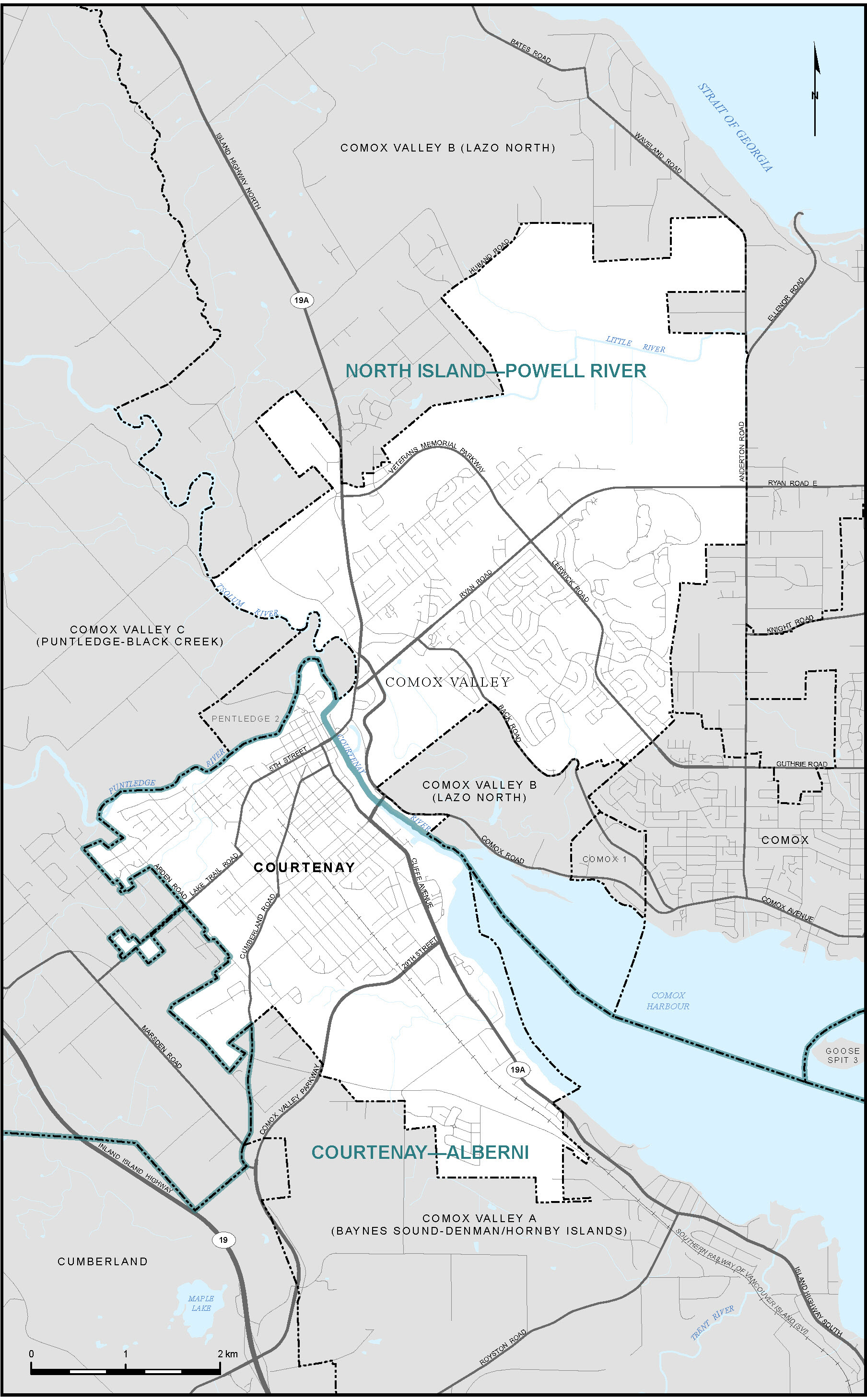
- Courtenay—Alberni
- Cowichan—Malahat—Langford
- Delta
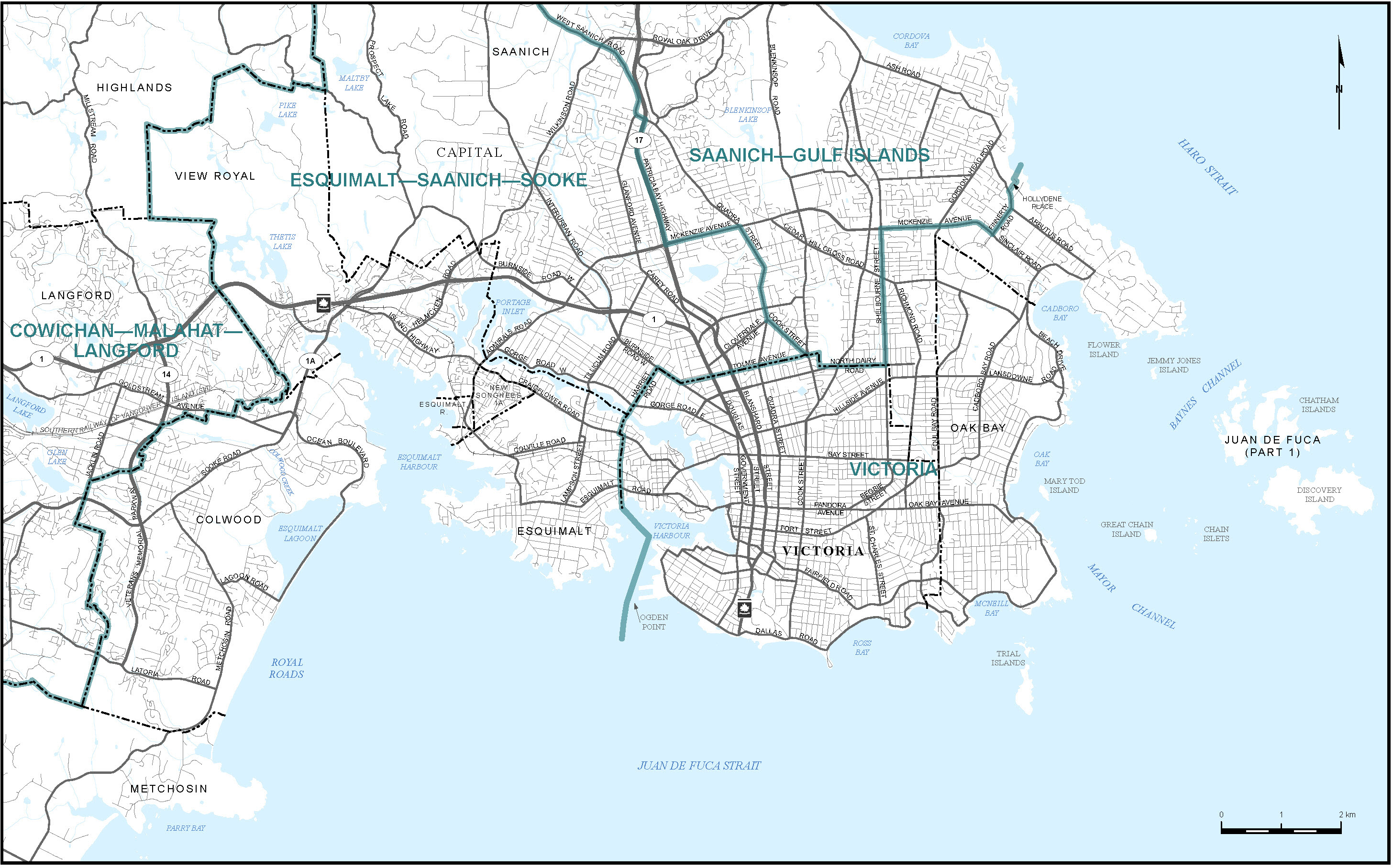
- Esquimalt—Saanich—Sooke
- Fleetwood—Port Kells
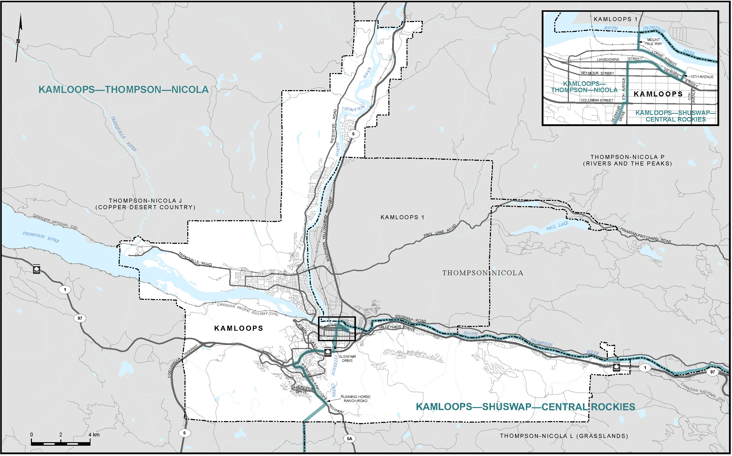
- Kamloops—Shuswap—Central Rockies
- Kamloops—Thompson—Nicola
- Kelowna
- Langley Township
- Mission—Matsqui—Abbotsford
- Nanaimo—Ladysmith
- New Westminster—Burnaby—Maillardville
- North Island—Powell River
- Okanagan Lake West—South Kelowna
- Pitt Meadows—Maple Ridge
- Port Moody—Coquitlam
- Prince George—Peace River—Northern Rockies
- Richmond Centre—Marpole
- Richmond East—Steveston
- Saanich—Gulf Islands
- Skeena—Bulkley Valley
- South Surrey—White Rock
- Surrey Centre
- Surrey Newton
- Vancouver Centre
- Vancouver East
- Vancouver Fraserview—South Burnaby
- Victoria
Maps
British Columbia (Map 1)
City of Courtenay (Map 6)
City of Kamloops (Map 7)
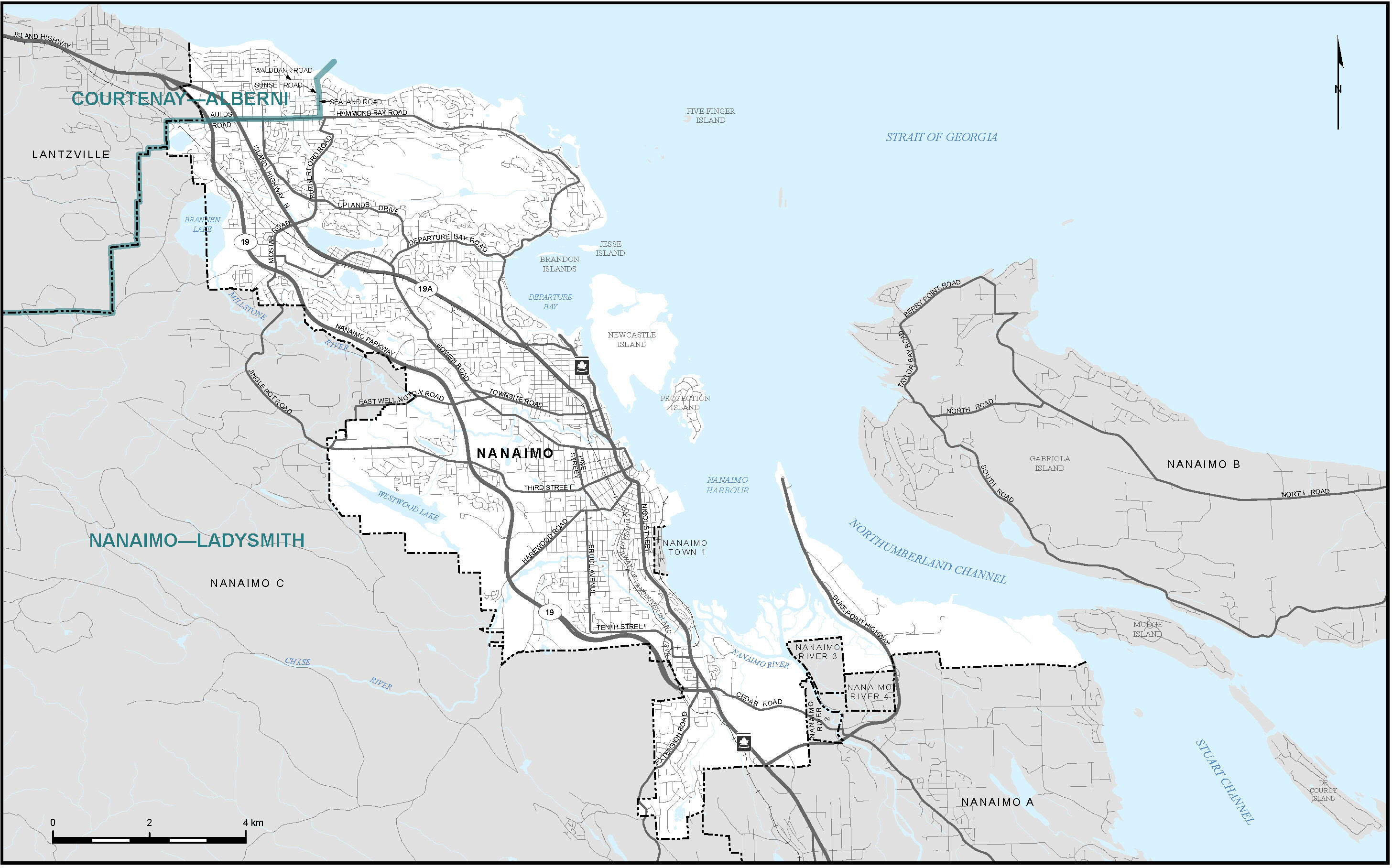
City of Nanaimo (Map 9)
City of Prince George (Map 10)

City of Victoria and Vicinity (Map 12)