
Commentaire 13 – commentaires et rétroaction
Les documents ci-dessous sont affichés dans la langue officielle d'origine tels qu'ils ont été reçus.
Retour aux commentaires et rétroaction du public
Connor Peters
Proposed Boundaries
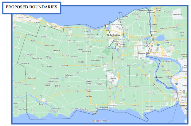
LINK TO PROPOSED MAP:
https://www.google.com/maps/d/edit?mid=11gLfGhqa8POyOI8hXjWMAuM9RTV4uY0&usp=sharing
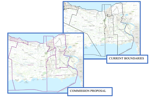
Current Boundaries and Commission Proposal
Niagara Falls:
Population: ~116,000
Boundaries: N – Lake Ontario
E – Niagara River (US Border)
W – Welland Canal, Hwy 58, Thorold Townline Rd., Welland River, McKenney Rd
S – Netherby Rd
Niagara South:
Population: ~121,000
Boundaries: N – Decew Rd, 406, St. Davids Rd, Hwy 58
E – Thorold Townline Rd, Welland River, McKenney Rd, Netherby Rd
W – Merritville Hwy, Quaker Rd, South Pelham Rd, Townline Rd
S – Lake Erie
Niagara West:
Population: ~112,000
Boundaries: N – Lake Ontario
E – Third St. Louth, QEW, Twelve Mile Creek, Merrittville Hwy, Quaker Rd, S. Pelham Rd., Townline Rd / Cement Plant Rd (Port Colborne municipal boundary)
W – Lincoln Municipal Boundary, Niagara Escarpment, West Lincoln Boundary, Haldimand Townline Rd.
S – Lake Erie
St. Catharines:
Population: ~115,000
Boundaries: N – Lake Ontario
E – Welland Canal
W – Third St Louth, QEW, Twelve Mile Creek
S – St. David's Rd, Hwy 406, Decew Rd