Commentaire 53 – commentaires et rétroaction
Les documents ci-dessous sont affichés dans la langue officielle d'origine tels qu'ils ont été reçus.
Retour aux commentaires et rétroaction du public
Ben Charlebois
Submission of the London West Federal Liberal Association
We would like to extend our gratitude to the Electoral Boundary Commission for the opportunity to participate in public consultations on riding redistribution. We appreciate the lengths to which the Commission goes to ensure that our electoral boundaries are balanced and considerate of the many unique communities that make up our ridings, and of the diverse populations who call those communities home.
London is growing, and growing fast as was acknowledged by many of the presenters at the public consultations.
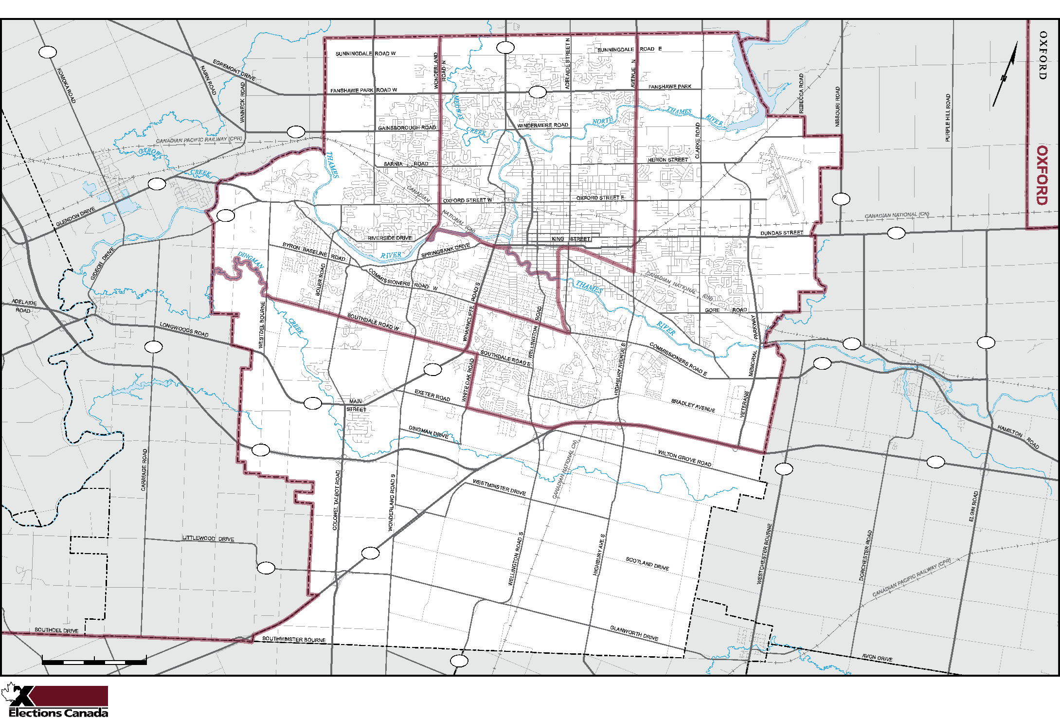
The Commission's new electoral boundaries remove three unique, established neighbourhoods from London West. These neighbourhoods are Wortley, Manor Park and Berkshire. These communities have been part of London West for over two decades and bear much in common with the established neighbourhoods in the riding of London West as it is. Considering the growth our city has experienced we understand that some change is unavoidable in aiming for a riding target value of 116,000. The current proposal poses significant challenges for rural individuals seeking assistance from their representatives, and places tightly knit communities in different ridings. It also fractures London in a challenging way - this city, with its significant growth that is both current and upcoming, does need three distinct urban MPs.
The Southern Edge of the Riding: The Village of Lambeth
Currently, the southern edge of London West travels along Southdale Road between Wharncliffe Road and Westdel Bourne, where it adjoins the river. South of this boundary, where there used to be farmland, now sit numerous new subdivisions, and further to the south is the village of Lambeth.
Although Lambeth has been a part of the City of London for many years, it has maintained a distinctive small town community identity which is quite unlike the new suburban neighbourhoods appearing to the north of Lambeth. Residents of Lambeth will happily tell those asking that they live in Lambeth, rather than London, and when you drive through Lambeth, you still drive past signs denoting town limits. Lambeth has not yet been geographically connected with the suburban neighbourhoods on the outer limits of London West, and we believe that until it has, it is practical to keep it within the proposed riding of London South – St. Thomas, which contains other communities of similar character, distinct from the sprawling development of London's more urban ridings. By keeping Lambeth in the riding of London South – St. Thomas, that riding would contain the entirety of London's southern border, including all of the communities bordering the Highway 401 and more importantly, all of the communities which border the vital agricultural space to the south of the city. This would allow for more unified representation on matters of urban development where some of the province's most valuable farmland is concerned. They deserve representation that reflects their needs.
We would therefore propose that the southern boundary of London West be drawn southward from its present boundary down to Pack Road, continuing east toward the Bradley Road extension and ending at Wharncliffe Road South, or alternatively, that the southern boundary be maintained at Southdale Road. This compromise of extending the boundary south to Pack Road would bring a substantial new development which borders London West into the riding and would keep the village of Lambeth whole. It would also bring London West's southern boundary closer to the southern boundaries of the other two urban London ridings, whereas under the Commission's proposal, London West extends much farther south than London Center and London Fanshawe.
Submission of the London West Federal Liberal Association
Population Impact
Adopting this boundary change would reduce the population of London West by approximately 6,300, for a total of approximately 115,000, according to online estimates. This population would be added entirely to London South – St. Thomas (Elgin – Middlesex – London under present boundaries).
Preserving an Existing London West Neighbourhood: Berkshire
Pulling the southern boundary of London West back up to Southdale or to Pack Road reduces the population of the riding and permits the re-inclusion of the Berkshire neighbourhood. This neighbourhood is the western portion of the space bounded by Springbank Road to the north, Commissioners Road to the south, Wonderland Road to the west and Wharncliffe Road to the East. This area's western portion (Berkshire) and eastern portion (Manor Park and the Coves) are distinct from one another in character and geography, separated by a tributary of the Thames River. The two neighbourhoods utilize different schools, businesses, services, parks, and more that would be placed in another riding under the commission's current proposal. Berkshire in particular has strong ties to the Springbank Park area. A large portion of the Berkshire neighbourhood services are titled with Springbank
in mind – like Springbank Medical Centre. To take Berkshire out of London West would be splitting it from the community that has developed between this area and Springbank.
Londoners deserve cohesive ridings, and we believe that keeping Lambeth under what would now be known as London-St.Thomas, and bringing Berkshire back into London West is the best way to do that.
Population Impact
Adopting this change would increase the population of London West by approximately 8,000, bringing the total to 123,000. This population would come entirely from London Center (London West under present boundaries).
Comments on the Proposal of the London Fanshawe NDP
While we agree with the intentions of the London Fanshawe NDP to ensure that ridings of primarily urban character represent London's urban areas, we disagree that their proposal satisfies this objective. The map proposed by the LFNDP maintains the southern boundary of the riding, which we agree is a defensible proposal for the express purpose of allowing Lambeth and other rural communities to affiliate with other similar communities until London's suburban development fully and finally bridges the gap between London and historically rural areas. However, the LFNDP proposal removes from London West numerous densely populated subdivisions within the boundary of London West. It places them in fundamentally rural ridings with which they share no sense of heritage or community. Residents of these neighbourhoods shop, work and access community services in London West, and their children go to London West schools.
The LFNDP proposal would remove the Hunt Club area (north of Oxford St. and west of Hyde Park Rd.), the Riverbend area (west of Commissioners and Oxford intersection, north of Oxford), and the Fox Hollow/Sunningdale area (north of Fanshawe Park Rd., south of Sunningdale Rd., west of Wonderland Rd. and east of Hyde Park Rd.). The Hunt Club area has been part of London West for decades, and the quickly growing Riverbend and Fox Hollow communities are relatively new suburbs of London West. Both communities are inseparable from London and have more in common with each other than with the rural ridings they would be joining under the redistribution proposed by the London Fanshawe NDP.
Northwest London, namely Hyde Park, Fox Hollow, and Riverbend are not a rural areas, they shop in urban London West, attend church, mosque, grocery stores and send their kids to school all in our urban boundaries of London West and we kindly urge the commission to consider this as they review the proposals that have been submitted.